- Home
- Bonnye Matthews
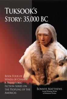
Tuksook's Story, 35,000 BC
Tuksook's Story, 35,000 BC Read online
TUKSOOK’S
STORY: 35,000 BC
BOOK FOUR OF WINDS OF CHANGE, A PREHISTORIC FICTION SERIES ON THE PEOPLING OF THE AMERICAS
BONNYE MATTHEWS
Award Winning Writer of Prehistoric Fiction
PO Box 221974 Anchorage, Alaska 99522-1974
[email protected]—www.publicationconsultants.com
ISBN 978-1-59433-521-1
eISBN 978-1-59433-522-8
Library of Congress Catalog Card Number: 2014956792
Copyright 2014 Bonnye Matthews
All rights reserved, including the right of reproduction in any form, or by any mechanical or electronic means including photocopying or recording, or by any information storage or retrieval system, in whole or in part in any form, and in any case not without the written permission of the author and publisher.
Manufactured in the United States of America.
Dedication
for Patricia and Robert
Contents
Acknowledgements
Introduction
Chapter One
Chapter One
Chapter Two
Chapter Three
Chapter Four
Chapter Five
Chapter Six
Chapter Seven
Chapter Eight
Chapter Nine
Chapter Ten
Chapter Eleven
Chapter Twelve
Bibliography
Websites
Attribution Credits
Neanderthal on cover: Author: Neozoom, License: Wikimedia Commons—Creative Commons Attribution—Share Alike 3.0 Unported
Background on cover: Author: Jens Mayer, License: Shutterstock 873269
Mammoth and Mastodon (page 20): Author: Dantheman9758 at the English language, Wikipedia License: Wikimedia Commons—Creative Commons Attribution—Share Alike 3.0 Unported
Scimitar Cat (page 20): Author: Dantheman9758 at en.wikipedia (http://en.wikipedia.org), License: Wikimedia Commons—Creative Attribution 3.0 Unported
American Lion (page 21): Author: Sergiodlarosa, License: Wikimedia Commons—Creative Commons Attribution 3.0 Unported
Musk Ox (page 21): Author: BS Thurner Hof, License: Wikimedia Commons—Creative Commons Attribution—Share Alike 3.0 Unported
Short Faced Bear (page 23): Author: Billy Hathorn, License: Wikimedia Commons—Creative Commons Attribution 3.0 Unported
Giant Moose (page 24): Author: Dantheman9758 at en.wikipedia (http://en.wikipedia.org License: Wikimedia Commons—Creative Commons Attribution 3.0 Unported
Camel (page 25): Author: ArthurWeasley, License: Wikimedia Commons—Creative Commons Attribution—Share Alike 3.0 Unported
Horse Bones (page 25): Author: FrankMonk, License: Wikimedia Commons—Creative Commons Attribution—Share Alike 3.0 Unported
Prehistoric Horse Painting (page 25): Author: FrankMonk, License: Wikimedia Commons—Creative Commons Attribution 2.0 Generic
Lupine: Author: Marc Ryckaert (MJJR), License: Wikimedia Commons—Creative Commons Attribution 3.0 Unported
All other images are in the public domain or have been taken personally.
Other Books in the Winds of Change Series:
Ki’ti’s Story, 75,000 BC
Manak-na’s Story, 75,000 BC
Zamimolo’s Story, 50,000 BC
Acknowledgements
Without the assistance of several people this book, as is true of the others in this series, would not be. These people are first, my brother, Randy Matthews, and then Sally Sutherland, Patricia Gilmore, Robert Arthur, and Pat Meiwes. Each contributed far in excess of what could be expected or hoped for based on family, friendship, or love of reading. I also thank my publisher, Evan Swensen, who had the courage to take on this project.
Finally, I wish to thank Kristine J. Crossen, Ph.D., Chair of Geological Sciences at the University of Alaska, who rescued me. I tried to research various geology publications in order to envision the land in the Cook Inlet area of Alaska in 35,000 BC. I was frustrated for two reasons: (1) I couldn’t do the geology research, because the jargon was like a foreign language to me and (2) I was concerned about writing about people in a place where there remains no trace of them today. Kris Crossen using wonderful teaching skills and without the jargon of geology funneled information that I needed down into a vision of the area so I could see it. She mentioned the damage from the Ice Age, helping me understand why, if people were present at that time, there would be no trace of them whatsoever. I could see the land forming and changing, and describe my People alive amidst the vegetation that would become coal deposits—coal deposits that now lie under the salt water of the inlet, singing their siren song to miners. Not only did she provide facts, but also she freed me to write boldly. I am very grateful for her help.
Alaska
Introduction
Tuksook’s Story, 35,000 BC takes place in today’s Cook Inlet in Alaska. In 35,000 BC, the area was nothing like it is today. There were geological, floral, and faunal differences. Since the flora is now coal deposits under the salt water, it’s not totally clear precisely what plants were present, so I have used the expected plants in the story. Dandelions were not endemic to the American continent; they were imported, so they are not present in this story as a useful green. Fauna differences were significant.
Present Day COOK INLET—US DOI BOEM Map (Volcanoes added.)
GEOLOGY
For the marine traveler to Alaska, Cook Inlet is a feature of mystical beauty. For Asian marine travelers, this wide body of salt water enters the mainland following the exquisitely placed snowy peaks of volcanoes and numerous islands that rise along the Aleutian Chain on the west. When the islands end great mountainous land begins. For marine travelers from the east, one travels north past Southeast Alaska and curves west where giant gem quality glaciers meet the Pacific Ocean in jaw-dropping grandeur before arriving at Prince William Sound where the glacier spectacle continues. Then the marine traveler continues west to the wide mouth of Cook Inlet. From either direction, the visitor is privy to scenes of geologic creation on a giant scale. There’s a sense of antiquity about this salt water entry to the great land, but it’s misleading. Cook Inlet isn’t all that old. The volcanoes and glaciers make their marks on the face of the land. Some very visible and some not-sovisible changes occur from the underwater subduction zone where the Pacific Plate relentlessly dives under the North American Plate. The great land is very much alive!
Mt. Redoubt Eruption 4/21/1990 (USGS)
Today’s most visible activity is volcanic. Volcanoes relieve the earth’s stress by creating land from above—spewing up ash and lava. Volcanoes are markers situated along the west shore of the Inlet, making picture-postcardworthy views from today’s populated east shore. Their unparalleled graceful contours speak of peace, while they hold enormous potential for destructive power. The volcanoes are not dormant. Mt. Redoubt (page12) stands more than half way up today’s Inlet. Mt. Redoubt and the other volcanoes gently remind all who live in the Cook Inlet area of their volcanic vitality by depositing occasional ashfall and rerouting planes. The land is not only alive—it has power which no human can diminish.
The invisible, underwater Pacific Plate pushes relentlessly north past Southeast Alaska. Stress release from the plate movement results in earthquakes. Alaska has many daily. The subduction zone’s progress enchantingly creates mountainous land on the east and west of the Inlet. As the Pacific Plate terminates, it dives under the North American Plate from the Aleutian Chain of islands on the west through Southcentral Alaska to the east. The Aleutian-Alaska Range and the Kenai-Chugach Mountains are the seeming magic result of sea floor riding on the back of the Pacif
ic Plate—shoved up from the deeps instead of subducted. Shoved up and pressed together—by the wizardry of earth’s perpetual tectonic motion along with the shaking and jolting force of earthquakes.
Go to the seashore. Scoop up some sea floor. Press it together with all the force you can bring to it. When you release it, it’ll fall apart. With the earth it is not so. Subduction creates majestic, non-volcanic mountains that hold together for many, many millennia. Magic! But, not illusory. The earth creates the real thing—seemingly mysteriously.
Not all land building becomes visible. During the 1964 earthquake, the sea floor in Prince William Sound rose fifty feet. The creative wizardry leaves messages behind. The visible, tall mountains contain marine animal fossils giving away the once lowly origins of their soaring heights. Living Alaska keeps man humble. He forgets or ignores danger signs at his own peril. Sometimes even when taking great care, he perishes from lack of any hazard pre-warning. That’s part of Alaska.
Ghost Trees—Personal Photograph Collection
There are reminders of the earth’s creative power all around Alaska. Saltwater encroachment leaves traces in the State, even beyond Anchorage, to the Knik and Matanuska Rivers’ exits into the brine. Today’s gray ghost forests document where the salt water rose during the earthquake of 1964. It left standing ghost forests as reminders. In some places such as Portage, ghost houses still visible today join the ghost trees. This land is in constant state of creation and re-creation, the most active of any place in the United States. Along with the exquisite beauty is the price of instability.
Mt. Susitna (The Sleeping Lady) from Anchorage
The Cook Inlet of today is a relative newcomer following the last Ice Age. It is only in recent geologic time that Cook Inlet formed. Sixteen thousand years ago, salt water made its way to the Kasilof area (between Kenai and Homer on the map on page 10), supplanting fresh water as the enormous ice sheet in the area melted. Thirteen thousand years ago, salt water reached Anchorage. Tuksook’s Story, 35,000 BC gives the reader a chance to reflect on what glaciation can do to the land by envisioning how it might have once looked. From 60,000 years ago to the time of this story, Cook Inlet was a long river valley draining the Kenai-Chugach Mountains to the east, the Talkeetna Mountains to the north, and the Alaska-Aleutian Ranges to the west. Before that time, there had been some glaciation where Cook Inlet now stands. Each successive glacial period widened the river valley. Along with the river 35,000 or so years ago, lakes, ponds, creeks, streams, and swamps filled the valley. Where the wide saltwater Inlet is today, it began as a relatively narrow fresh water route from the mountaintops to the sea, and great forests grew on either side of the rivers and creeks and streams. Consider the last Ice Age effect. From about 20,000 years ago for about 10,000 years or more, ice covered the land in some places to about a mile deep. Ice completely covered Mt. Susitna (page 14) for a time, leaving behind erratics, boulders from another place, at the top of the mountain. Imagine the first people who saw the erratics trying to solve the conundrum of those out-of-place boulders. The people in this novel would have seen the mountain before it was deformed.
Used with permission from the State of Alaska, Alaska Historical Commission (from Alaska’s Heritage, Joan M. Antonson and William S. Hanable, 1986, page 7)
In Alaska during the Ice Age, only the areas shown in white on the map on page 15 remained ice free. In the ice-free areas grasslands flourished, providing refuge for the surviving species. Remnant glaciers continue growing and withdrawing off and on into our time. Imagine a glacier extending from the origins of the Susitna, Knik, and Matanuska Rivers and Turnagain Arm to its exit at the Pacific Ocean. The glaciation that formed Cook Inlet was part of an ice sheet that extended from Alaska into Canada and what is now a good part of the United States. To call it enormous may be a gross understatement. Theoretically, in the gray area at the bottom of the map in Southcentral Alaska, even the tops of Pioneer Peak, Matanuska Peak, and parts of the central Talkeetna Mountains and Chugach Mountain tops, greater in height than a mile, remained free of ice during the last Ice Age. The great volcanic mountains, such as Sanford and Drum to the north, and the volcanic mountains on the west side of what is now Cook Inlet would have peaked out of the ice sheet. Massive Ice Age glaciation would have scraped any form of human evidence from the surface of the earth, ground it to dust, or dumped it into the ocean or a moraine, as if it never existed. Ice scoured out the narrow river valley to create the wide Inlet of today, leaving a wealth of underwater coal resources from those once lush forests. As the massive glacier retreated, salt water entered the carved out former fresh water environment. It would backfill the area that had once denied it access. Beluga whales, salmon, huge halibut, sea otters, seals, sea lions, and a myriad of other marine life now swim where once mammals roamed. We can envision the old valley from glimpses of the present.
How Cook Inlet Might Have Looked Before the Last Ice Age (NOAA)
Tuksook’s Story, 35,000 BC tells of this pre-Ice Age time in the Cook Inlet region. The People fled a severe drought in the China/Mongolia area to find a place with meat and water to satisfy their basic needs. The valley provided more than the basic needs of life. They and their heirs thrived in the great land for thousands of years, exploring and enjoying its bounty until the Ice Age arrived. Following the Ice Age, every shred of evidence of their passing through the land vanished, as if they’d never been there. Their stories only whisper in the winds.
Aurora Borealis Presenting in Red (NASA Image)
Finally, Cook Inlet is within viewing range of the aurora borealis (northern lights). One of the rarest presentations of the “lights” is a red sky. The illustration above of the red “lights” will let you share what the People see at the beginning of Chapter Five. The book’s cover shows the “lights” in color.
FLORA
Because of the ice sheet, there is no way to prove except by imprints in rock what plants were present in the Cook Inlet area before the Ice Age, I have chosen to focus on plants that many people have not seen but are very common in Alaska. The plants or near relatives one might expect in the area of 35,000 BC could have consisted of cone-bearing evergreens, hardwoods such as birch, aspen, alders, cottonwoods, willows. There most likely were ferns, grasses, blueberries, cranberries, ligonberries, salmonberry, watermelon berries, mushrooms, grass, cotton grass, coltsfoot, wild chive, fireweed, cow parsnip (wild celery), wild rose, yarrow, stinging nettle, horsetail, mare’s tail, and so on. It might be noted that as they arise in spring, some ferns produce fiddleheads, curled stems that unfurl in time. They are edible when tightly curled, and the People use them, but they never heard of a fiddle. They call them fern fists. There were also numbers of plants that were poisonous: buttercup, monkshood (wolfbane), wild sweet pea, lupine, wild calla, devil’s club, water hemlock, elderberry pith, larkspur, some mushrooms, and all anemones. Sometimes plants look alike but are very different. For example, people not accustomed to seeing the differences could confuse edible and poisonous look-alikes.
Here are some examples of plants in the Cook Inlet region:
(Yes, I’m standing level with the plant.)
FAUNA
Pleistocene fauna, just as flora, is impossible to pin down. The ice sheets would have removed evidence. We do know that north of Cook Inlet in the large refuge areas north of the Talkeetna Mountains, there is a better picture of pleistocene fauna. Examples of Alaska’s pre-Ice Age fauna are: woolly mammoth, mastodon, scimitar cat, American lion, musk ox, steppe bison, dire wolf, short faced bear, giant moose (stag moose), giant beaver, camel, horse, Dall sheep.
Some Alaskan Pleistocene Fauna
WOOLLY MAMMOTH. These animals lived on the tundra (treeless plain of flat or rolling land). They grazed on grasses and vegetation. Predators that sought them were the scimitar cats and the American lions.
MASTODON. The mammoth and mastodon are often confused. In the picture above the mammoth is on the left and the mastodon on the right. They somet
imes shared the tundra for browse, but mastodons had different teeth which enabled them to browse tree twigs and branches in forests, places where mammoth teeth would be a problem. Mammoths didn’t have the teeth to eat the tough material the mastodon could chew.
SCIMITAR CAT. This cat is rarely mentioned, and therefore it’s lesser known than the saber toothed tiger. It was one of two cats that roamed Alaska prior to the Ice Age. Its prey were mammoths and mastodons.
AMERICAN LION. This cat could have preyed on any of the numerous plant eaters.
MUSK OX. These animals require cold, normally arctic environments. They may not have come as far south as the Cook Inlet area. There is, however, a musk ox farm near the north end of Cook Inlet, but that is a farm, not a natural setting. The musk oxen there seem to fare quite well. Musk oxen are not included in the story.
STEPPE BISON. This steppe bison was found in the Fairbanks area and is a complete specimen. It resides at the museum at the University of Alaska Fairbanks. They call it Babe.
Steppe bison were not limited to Alaska. An artist in Spain painted one as shown above. It gives us a fuller picture when coupled with Babe to know what they may have looked like.
DIRE WOLF. Dire wolves, pleistocene animals like musk oxen, probably didn’t live in the Cook Inlet area. The farthest north one has been recorded is Alberta, Canada. Of course, lack of evidence is not evidence of lack. They may have lived in areas of Alaska where the ice sheet would have removed all trace of them. They are not featured in this story.

 The SealEaters, 20,000 BC
 Tuksook's Story, 35,000 BC
 Zamimolo’s Story, 50,000 BC: Book Three of Winds of Change, a Prehistoric Fiction Series on the Peopling of the Americas (Winds of Change series 3)
 Ki'ti's Story, 75,000 BC
 Manak-na's Story, 75,000 BC
 Zamimolo’s Story, 50,000 BC